“Penn State President Eric Barron announced today (Dec. 11) the University is investigating ways to conserve land it owns roughly between Whitehall Road and Rothrock State Forest at Musser Gap, in Ferguson Township just outside of the University Park campus.
“Our vision for this area is to not only help protect the local water supply, plant and animal species, but also make it a place where people can enjoy nature, learn about the environment and be inspired,” Barron said.
The 365-acre property, which is being referred to as the Musser Gap to Valleylands (MG2V) site, includes the Musser Greenway Trail and is bordered by Rothrock State Forest and the proposed Whitehall Road Regional Park.
As part of the work, the University is partnering with the ClearWater Conservancy, a non-profit organization that aims to conserve and restore the natural resources in central Pennsylvania, which will work with the community and seek input from local residents…”
For reference, this is most of the acreage that Nittany Valley Environmental Coalition and its precursors (Nittany Valley Water Coalition and a phalanx of loosely organized citizen activists) have been fighting since early 2015 to protect from the domino-effect of intensive land development set off by Penn State’s rezoning and sale of the 46 acres now under development by Toll Brothers for luxury student housing.
The most publicly-visible citizen action was the citizen occupation of the Toll Brothers site, which ran from June 3 through October 8, 2017, in an effort to engage Penn State and Toll Brothers in a land swap and keep the student housing development off the watershed.
Penn State evicted the occupiers on October 8, 2017, claiming that the land would be farmed in winter wheat while negotiations for the land swap proceeded. Then on December 21, 2017, after apparently rebuffing overtures from Toll Brothers executive Charles Elliot to engage in the land swap, Penn State closed the sale.
By unit vote on Monday, October 29, the five municipalities that participate in the regional parks program voted to endorse the easement, thus clearing the way for Toll Brothers contractors to start blasting and excavating in the Harter-Thomas recharge area in the coming weeks, and to ultimately build a large sewage holding tank and high-pressure sewage pipeline about a mile from our main public water supplies.
On November 2, Toll Brothers’ representatives had the land development plan recorded with the Centre County Recorder of Deeds.
Likely next steps for NVEC include:
Citizen engagement in the State College Borough Water Authority’s data collection and analysis, from a SCBWA water monitoring well to be drilled in the lower right corner of the construction site, just below two large stormwater infiltration basins;
Continued work to protect the Regional Growth Boundary and prevent the remaining Penn State-owned acreage in Ferguson Township (surrounding the combined Toll Brothers “Cottage”/Whitehall Road Regional Park projects) from further development;
Advocacy for structural reforms at the Centre Region Council of Governments, to increase the efficacy of concerned citizens and promote robust fact-finding and deliberative processes among General Forum members on controversial regional issues.
Public Comment sent to COG General Forum Friday, October 26, ahead of COG General Forum meeting Monday, Oct. 29:
First, I would like to thank the State College Borough Council for the “No” unit vote cast at the Sept. 24, 2018 COG General Forum meeting.
That vote gave concerned citizens the time to find and fit together the last few procedural puzzle pieces, compiled in the attached document – 10.26.18 Exhibits to COG (PDF, 59 pp., 29 MB; replaces prior exhibit package posted 10.24.18)
I’m working on a fuller Bailiwick News narrative explaining the history, but due to the complexity of the issues, it will likely not be finished until Monday, Oct. 29 at the earliest.
To give legislators more time to consider the information, I’m forwarding a collection of documents today, related to the sewage flow figures used in permitting documents to date, the relationship of those figures to DEP regulations regarding capacity calculations, and the relationship of those calculations to state laws regarding false statements made to and relied upon by public servants in approving or denying development applications.
The document collection includes text notes on each exhibit, to assist readers in navigating the procedural history.
In sum, PennTerra engineer John Sepp, working on behalf of Toll Brothers, has since 2014 under-reported projected sewage flows from the Cottages and Whitehall Road Regional Park developments to numerous public authorities, including Ferguson Township, UAJA, DEP and the general public, using 47,950 gallons per day for the combined developments when he should have used at least 110,350 gallons per day. Each of the government entities relied upon the incorrect numbers to approve various plans, permits and legal agreements.
If Sepp had provided accurate sewage flow calculations to Ferguson Township, and subsequently complied with the resulting DEP public notice requirement, he or Ferguson Township would have published, in the Centre Daily Times, in November or December 2014 — at least 30 days before the Ferguson Township Board of Supervisors had on its agenda to review the Sewage Planning Module for the first time on January 19, 2015 — the following information:
Name of Project – The Cottages at State College and Whitehall Road Regional Park
Type of development – Multifamily residential, 268 units, to house 1,093 people, plus regional active sports park.
Location – Intersection of Blue Course Drive and Whitehall Road.
Acreage under development and number of equivalent dwelling units – 143.7 acres under development: 43.7 acres for housing, 100 acres for regional park, and 631 EDU (625 for Cottages, 6 for park).
Type of sewage disposal proposed – Sewage holding tank, pump station and high-pressure force main pipelines to UAJA system.
Reason why publication was necessary – At least 110,350 gallons per day new sewage flow will enter the UAJA conveyance and treatment system if these projects are built.
A 30-day comment period will run from date of publication [to a date prior to Ferguson Township supervisors’ first review of the application.]
The Complete Sewage Facilities Planning Module application package may be reviewed by the public during business hours at the Ferguson Township Municipal Building, 3147 Research Drive.
Public comments will be accepted at Ferguson Township Municipal Building, 3147 Research Drive., and will be forwarded to the Department of Environmental Protection, along with municipal responses to all comments received.
That concise, summarized project information was not published by Sepp or Ferguson Township, in November or December 2014, or at any time before or since, depriving the public of an opportunity to make timely public comments and to have those comments inform Ferguson Township, DEP and UAJA decision-making.
Given the falsification of the sewage flow numbers, the avoidance of timely, concise public notification, and the linking of the Whitehall Road Regional Park development to the Cottages housing development through the 2008 Penn State subdivision plan (Exhibit B), I urge General Forum legislators, and especially State College Borough Council members, to vote to deny the easement request currently before you, and by that action, return both the Cottages and the WRRP plans to the drawing board to create more legally-compliant, ecologically-sound projects in this sensitive public water supply area.
I further urge General Forum members to formally release Toll Brothers from the 2008 obligation to provide sewer and other infrastructure to the park, so that public officials can proceed independently, without having decisions about publicly-funded projects ethically compromised by entanglement with private profit motives.
Please do not hesitate to contact me for additional information or complete copies of the documents from which these exhibits have been excerpted.
Thank you for your public service.
/s/ Katherine Watt, Editor and Publisher, Bailiwick News
Sent by Brian Heiser, Executive Director of State College Borough Water Authority, to Kathleen Matason, Chair of Centre Region Parks & Recreation Authority Board, and Pam Salokangas, Centre Region Parks & Recreation Director, regarding Whitehall Road Regional Park design.
State College Borough Water Authority Board Comments on Whitehall Road Regional Park
Dear Ms. Matason,
At the regular meeting of the State College Borough Water Board of Directors (SCBWA) on Thursday, October 18, 2018, the Board decided to submit comments drafted by the Source Water Protection Committee as comments supported by the entire Board of Directors.
SCBWA would like these comments to be considered as areas of concern that supersede any previous comments made by this board.
SCBWA is not taking a position of approval or disapproval for this project bout would like our concerns considered as you proceed with the design and approval process for the Whitehall Road Regional Park (WRRP).
We have arranged and differentiated these comments as concerns of high priority with respect to protecting our source water, and additional concerns that should be considered in completing your design.
High Priority Concerns
Final site design should minimize the amount of grading and rock excavation.
The entire eastern third of Phase 1 should remain in an undisturbed state.
The length of the access road should be minimized.
The location of the sewage pump station should be selected to minimize the length of the sewer force main.
No artificial turf should be used. All fields should be constructed with natural turf.
Additional Concerns:
Rock excavation should be performed using pneumatic hammers or other similar measures.
Any drilling or blasting required for site construction should be coordinated with Ferguson Township and the SCBWA. Monitoring protocols established by the SCBWA should be followed for all blasting.
CRPR’s turf management plan should be submitted to SCBWA for review and approval.
CRPR’s plans for soils and seed mixtures used in detention basins, swales, and channels should be submitted to SCBWA for review and approval.
No dog park should be included in the design
We respectfully request that you consider these comments as the Centre Region Parks & Recreation Authority proceeds with the development of the first phase of the park.
Thank you for considering the comments in this letter.
We respectfully request that this letter be distributed to the members of the COG General Forum.
Should you require any additional information please do not hesitate to contact Brian Heiser, Executive Director of the SCBWA, or Gary Petersen, Chair of the Source Water Protection Committee.
Respectfully,
Board Members: Jeff Kern, Chairman; Rachel Brennan; Emory Enscore; Gary Petersen; Jason Grottini; Bill Burgos; Bernard Hoffnar
/s/ Brian Heiser
cc: Jim Steff, [COG Executive Director]; David Pribulka [Ferguson Township Manager]
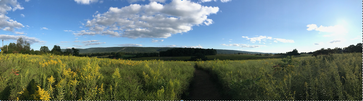
Depiction of the Whitehall Road area by Randy Hudson, showing land parcels, hiking/biking trails, streams, roads, swales, public water wells, municipal boundaries, and Musser and Shingletown gaps. Oct. 10, 2018
Toll Brothers contractors have started clearing their Whitehall Road parcels, including cutting down a woodlot, in the last few weeks.
They have also started notifying nearby residents of planned “controlled blasting” of bedrock to begin in a few weeks.
However, they don’t yet have one of the “easements” required for sewage pump station construction.
As 2018 began, Toll Brothers restarted its permitting efforts and Whitehall Road Regional Park advocates continued updating their plans and project budgets preparatory to submitting a land development plan application to Ferguson Township.
In early 2018, PennTerra Engineers working for Toll Brothers approached the SCBWA seeking an easement to be able to construct a 1,200-foot portion of a force-main pipeline (total length just under a mile) on SCBWA’s deed-restricted conservation land. The force-main was to convey sewage under high pressure from the pump station at the bottom of the hill, up to Whitehall Road, then along Whitehall Road toward Stonebridge Drive.
The application process was difficult, because several SCBWA board members took seriously the deed restriction on the land they had purchased from Penn State in 2008, which required that it be used for conservation purposes only, in perpetuity.
Although Toll Brothers attorneys and the SCBWA’s own solicitor attempted to downplay the ethical and legal significance of the deed language, the SCBWA board held two votes, neither of which approved the easement.
The May 2018 SCBWA vote was a 3-3 tie. When the resolution returned to the agenda for another vote in July 2018, the SCBWA board denied the easement request by a 4-1 vote. “No” votes were cast by Bernie Hoffnar, Bill Burgos, Rachel Brennan and Jason Grottini. Gary Petersen cast a “Yes” vote, Jeff Kern abstained and Emory Enscore was absent.
It was a remarkable result, forcing Toll Brothers to reroute the high-pressure force main along Ferguson Township’s municipal roadway (the proposed Blue Course Drive extension) and along PennDOT’s existing state roadway (Whitehall Road).
Pump Station Design and Siting
For several years, it’s been hard to pin down the planned location, capacity and other specifics of the sewage management plan, because the various land development plans in circulation depicted the pump station in at least two different locations.
On Toll Brothers private housing development plans as approved by Ferguson Township in 2015, the pump station was located on public Whitehall Road park land jointly owned by CRCOG and Ferguson Township.
However, on the Parks Authority’s 2010 master plans for the Whitehall Road Regional Park – as approved for funding by the CRCOG General Forum – the pump station was located on Toll Brothers private land.
Stahl Sheaffer Engineering site plans for the park showed a pump station with a footprint of 37’ by 50’ on public parkland as early as April 2014.
But between 2014 and the present, park advocates made no effort to seek unanimous General Forum consent to amend the master plan to add the pump station, despite the requirement that master plan amendments can only be made by General Forum, and only by unanimous unit vote...
Throughout Spring and Summer 2018, CRPR Director Pam Salokangas – working on behalf of the Parks Authority – was still publicly circulating versions of the Whitehall Road park design plans that excluded the proposed pump station on public land, to municipal legislators, SCBWA and other entities.
Salokangas was circulating these misleading plan documents even as PennTerra Engineering, working for Toll Brothers, was actively seeking the last few approvals, permits and easements for the sewage system infrastructure from SCBWA, PennDOT and UAJA, using plans showing the pump station on park land.
Over the spring and summer, as the force main route debate played out, more information about the proposed pump station became public.
According to DEP sewage planning module documents circa 2015, the pump station was designed to manage a projected 47,950 gallons per day (gpd) of raw sewage: 98% of it coming from the students in the private luxury housing development (268 Equivalent Dwelling Units at 175 gpd) and 2% of it from public Whitehall Road Regional Park visitors (6 EDUs at 175 gpd).
However, 48,000 appeared to be a significant underestimate, intended to stay just under the threshold of 50,000 gallons per day at which PA-DEP requires a public hearing.
The UAJA board approved the plans for the pump station and associated pipeline infrastructure on August 15, 2018, after several rounds of revisions.
Shortly after the UAJA vote, the volume misrepresentation was corroborated by language in an August 23, 2018 draft sewage management plan obtained from UAJA. The August 23 plan notes that Toll Brothers used UAJA’s Equivalent Dwelling Unit (EDU). One UAJA EDU is 175 gallons per day per household, based on 2.5 people per household and 75 gallons per person per day.
Yet since 2015, the Toll Brothers plan has been to construct 268 units to house 1,093 undergraduates in mostly 4- and 5-person units, roughly a doubling of the people per household from the factor used in the DEP application. At 75 gallons per person per day for 1,093 people, the pump station’s baseline sewage flow from the student population will be about 82,000 gallons per day.
According to the August 23, 2018 plan, Toll Brothers is now projecting a “peak” flow of 191,800 gallons per day, far above the 47,950 gallons per day average used in the 2015 DEP sewage planning module application.
Toll Brothers also recently increased the diameter of the “wet well” (sewage holding tank) to 10 feet and the depth to 26.5 feet. To build it, Toll Brothers contractors will dig a giant hole in the fracture- and sinkhole-prone watershed 28-feet deep, build the tank, and then backfill earth back into the hole around the cylinder.
The volume of that cylinder, converted from cubic feet to gallons, is about 15,575 gallons.
At peak flow of about 192,000 gallons per day – or 8,000 gallons per hour – the August 23 plan states that the wet well has 30 minutes of emergency storage in the event of a pump failure or other malfunction, before overflows into the watershed start.
UAJA Director Cory Miller has said in public comments to the SCBWA (April 19, 2018) and in email correspondence that backup systems include multiple layers. The pump station has redundant pumps and motors, so if the first pump fails, the second, backup pump will be deployed. Spare pumps are kept at the main UAJA facility.
For a power outage, there’s to be an on-site natural gas- fired backup generator providing electricity to run the pump station. The generator will be supplied by a natural gas pipeline crossing the sinkhole-prone karst terrain.
If those backup systems fail, then UAJA will pump sewage out of the Shit Pit into trucks and drive the trucks to the nearest manhole providing access to gravity sewage conveyance lines, at about 5,000 gallons per truck trip.
And if UAJA trucks are unable to reach the pump station, resulting in an overflow from the Shit Pit, the plans call for a “diked area within the pump station easement to capture anything that spills.”
There are at least four plausible disaster scenarios, including leaking, overflowing, flooding due to torrential downpours like the rainy summer we’ve just had, and natural gas line breakage leading to an explosion like the recent Columbia Gas sequence in Massachusetts.
Of those, the most likely is probably leaking: a sinkhole or fracture opening up near the wet well, creating a leak that’s large enough to rapidly put a stream of sewage into the public water supply, but small enough to evade detection by warning floats in the tank, such that the SCADA system back at UAJA doesn’t register a problem.
After design and construction by Toll Brothers contractors, UAJA, which is a public utility funded by ratepayers, will own, maintain and operate the pump station, the force main and most associated infrastructure.
Toll Brothers, or any entity to which they sell the student housing complex, will be legally responsible for damages related to malfunctions of individual customer sewage gravity lines that carry sewage from each apartment to large gravity mains that will carry the sewage to the pump station down the hill.
COG and Ferguson Township taxpayers will be legally responsible for damages resulting from failures in individual lines from the park bathrooms to the wet well and pump station.
UAJA ratepayers will be liable for damages – including contamination of public water supplies – resulting from malfunctions starting at the point where the individual apartment sewer lines connect to the main gravity line, through the Shit Pit, up the high-pressure pipeline, along Whitehall Road, to Stonebridge and on to the UAJA treatment plant.
Costs for those malfunctions might be covered by UAJA insurance policies but might well be excluded from coverage, depending on the reasons identified for the malfunction and resulting public water contamination…
At a bare minimum, if one or both of the joint developments are constructed, and when the inevitable catastrophes occur – whether due to shoddy design (including volume lowballing) or construction, human error in operations, gasline explosions, or natural disasters like floods and sinkholes overwhelming the backups to the backups, the resulting finger-pointing and litigation will be epic…
August 2018 Governance
Before Toll Brothers contractors can physically enter the regional park land and start excavation without legal objection from UAJA and without potentially being charged with criminal trespass and vandalism, the company must provide UAJA with proof of the landowners’ consent, in the form of access “easements.”
As described above, Ferguson Township and the Centre Region Council of Governments own the park land jointly, and Ferguson Township owns the Blue Course Drive Extension land, including the proposed route of the force main.
This hurdle directly implicates the bizarre legal relationships among the appointed Centre Region Parks and Recreation Authority board, responsible for design, planning and construction of the park; the Centre Region Council of Governments organization comprised of six participating municipalities and their paid administrative staff, serving as a pass-through for park development funds; and the elected legislatures of the participating municipalities, responsible for using their taxing authority to fund park development, in this case through a 2011 Fulton Bank loan extended several times in the intervening seven years…
Moving into August 2018, NVEC learned that the Parks Authority board would try to take another step toward realizing their taxpayer rip-off vision, when CRPR Director Salokangas was scheduled to appear at the CRCOG General Forum meeting on August 27 for another information-only update.
In the weeks before the August 27 meeting, NVEC documented environmental problems with the proposed Whitehall Road Regional Park design, through multiple communications submitted to CRCOG and Ferguson Township Board of Supervisors including graphic representation of community regional park preferences collected in 2008 by the Centre Region Parks and Recreation Authority and collated by NVEC in July 2018.
The survey data showed overwhelming public support for ecologically-protective park land uses far outweighing public support for highly invasive grading for rectangular sports fields.
NVEC further provided graphic representations about the planned Whitehall Road park budget allocations – based on the limited information made publicly available by the Parks Authority – showing the disproportionate amounts allocated to rectangular fields as compared to natural, minimally-disturbed areas.
In NVEC’s communications, the group noted that the Parks Authority board had not addressed Ferguson Township supervisors’ design concerns and suggestions outlined in an August 17, 2016 letter to CRCOG and a March 21, 2018 letter to the Parks Authority board.
NVEC noted that the Parks Authority board had not consulted with the State College Borough Water Authority board – especially its Sourcewater Protection Committee – regarding risks to public water supplies from the proposed development, as requested during Salokangas’ presentation at SCBWA’s April 19, 2018 meeting, SCBWA’s April 24, 2018 follow-up letter, and SCBWA’s June 26, 2018 follow-up email.
NVEC further noted that, at General Forum on August 27, the Parks Authority board intended to propose a Phase 1 development plan with a base cost of at least $6.1 million for grass fields with no lights, and a base cost of $9.4 million with artificial turf fields and lights. This proposal, which had been presented at an August 16, 2018 Parks Authority board meeting, contrasted with an allocated maximum budget of $4.8 million per Patton Township’s letter to the Parks Authority dated Oct. 19, 2016 and the COG General Forum funding vote on May 22, 2017.
As it happened, Salokangas did not provide the $6.1 million budget during her General Forum presentation on August 27.
She only provided drawings.
General Forum members began by considering a motion proposed by Ferguson Township supervisor Steve Miller, for General Forum to “receive the report…and convey to the Centre Region Parks and Recreation Authority support for the design elements in the concept plan as well as any additional design modifications authorized by the authority in order to remain within budget.”
The motion failed to carry.
It was then amended, to only “receive” the report, but withhold General Forum “support” for the design and additional modifications. The amended motion passed 13-11, according to the meeting minutes.
After the meeting, Ferguson Supervisor Laura Dininni circulated her personal photos of paper copies of the budget, which she had obtained by personal attendance at the August 16 Parks Authority board meeting, to her fellow municipal legislators by email.
September 2018 Governance
The September 13 joint Parks Authority-Parks Capital Committee meeting was cancelled, presumably to prevent deliberation of the issues by the COG General Forum’s Parks Capital subcommittee, comprised of elected legislators.
Instead, the appointed Parks Authority board held its regular, solo meeting on September 20. According to Dininni, at that meeting, Salokangas sought and received an endorsement from the Parks Authority board to move forward with the park land development process in Ferguson Township, despite General Forum’s refusal to support the revised design, and despite park proponents repeated failures to obtain, incorporate, or address the expressed concerns and interests of Ferguson Township supervisors, SCBWA board and staff, low-impact park user groups, and environmental organizations.
By mid-September, the Ferguson Township Board of Supervisors was preparing to consider a request from Toll Brothers for an easement to allow the developer to construct the proposed high-pressure sewage force main to serve the Cottages student housing development and the future Whitehall Road Regional Park along the future Blue Course Drive extension.
Over citizen opposition, expressed in writing before the meeting and in person at the meeting, the supervisors voted 4-1 on September 17 to grant Toll Brothers the easement. “Yes” votes were cast by Peter Buckland, Steve Miller, Sara Carlson and Tony Ricciardi.
The only “No” vote was cast by Laura Dininni.
On Monday, September 24, the CRCOG General Forum – which includes all the elected legislators from State College, Ferguson, Patton, Harris, College and Half-moon – considered the second part of Toll Brothers two-part easement request, this time for the sewage pump station and Shit Pit, and the pipeline portions to be located on public park land.
Township supervisors and borough council members voted as municipal units – requiring a majority “Yes” on each municipal board to comprise a collective unanimous unit approval.
The State College Borough Council voted “No,” by 6-1. Janet Engeman, Jesse Barlow, Theresa Lafer, Cathy Dauler, Evan Myer, and David Brown voted to deny the easement request. Dan Murphy voted to grant it.
Meanwhile, the Patton Township Board of Supervisors voted to abstain from the decision, citing a lack of information.
The wording of the motion considered September 24, means that General Forum will consider the easement request again on October 29, after lawmakers submit questions to COG Executive Director Jim Steff and Steff distributes additional information in response.
*For more detailed background – see10.4.18 Bailiwick News, which covers the Whitehall Road area in Ferguson Township; its sinkhole- and fracture-prone karst geology; historical farming use; SCBWA water wells; Centre Region and Penn State population growth; regional planning frameworks; Penn State real estate dealings, zoning and land development activity in the area since 1999; COG efforts to fund and construct regional parks through the Centre Region Parks & Recreation Authority; DCNR grant funding for park land purchases; how park planning included many active sports proponents, but excluded land, water and habitat conservation groups, particularly SCBWA, and resulted in an overbudget design involving heavy grading during construction and high maintenance post-construction; citizen pushback campaigns that started in March 2015; a litigation round that ended in November 2017 when the Pa. Supreme Court denied Nittany Valley Water Coalition’s appeal; and a direct action (site occupation) campaign for a “land swap” to place the proposed luxury student housing development on less-risky land owned by Penn State, which ended in December 2017 when Penn State and Toll Brothers closed the sale of the Whitehall Road site…
Crebilly Farm in Westtown Township is one of the last large expanses of unspoiled, unprotected open space in eastern Chester County, Pennsylvania. It’s also land on which part of the Battle of the Brandywine was fought on September 11, 1777, with Hessian Jaegers – who were attempting a flanking maneuver of the American lines – taking artillery fire from the American position at Sandy Hollow near the Birmingham Friends Meetinghouse.
Yet despite this land’s historical importance, Toll Brothers has proposed a huge 317 unit housing development on these hallowed 325 acres where our forebears fought and died for our freedom.
As you know, Neighbors for Crebilly has been permitted by Chester County Common Pleas Court to intervene in Toll Brothers’ appeal of Westtown’s denial of their conditional use application. Oral arguments in this appeal will made this Monday, September 17th at 1 pm in courtroom #1. Please join us if you can.
A quick word about Toll’s legal arguments which, as you can imagine, mock reality. Their lawyer, Greg Adelman, actually argued in a recent brief to the court that the Environmental Rights Amendment should not be applied to the “conditional use process,” a bizarre line of argument to say the least, and that our legal brief should be quashed. What Toll would have the court believe is that laws passed by the PA state legislature – including the PA municipal planning code of which the “conditional use” process is a part – must not be examined or questioned in terms of their impact on the environment.
In other words, the legislature, according to Toll’s lawyer’s flawed reasoning, can pass any law it chooses regardless of the harm it causes the environment, and the courts must not weigh in on those laws.
But outside Toll’s time-space distortion bubble, Courts strike down unconstitutional legislation all the time. As this conditional use application from Toll Brothers would permanently impair environmental and historic resources at Crebilly Farm, the Environmental Rights Amendment must take precedence over the conditional use process since the state Constitution supersedes all laws passed by the legislature.
That’s why the process of amending the constitution is so onerous: the amendment must pass the two legislative houses in two consecutive terms and then be approved by voters. Therefore, the unanimously-passed Environment al Rights Amendment (Article 1, Section 27) of our state constitution, outweighs laws passed by the legislature. This amendment guarantees environmental protection for allpeople in the Commonwealth, including generations yet to come. So it is plainly ludicrous for Adelman to argue that the E.R.A. must not be considered in the conditional use process.
It was also curious that Adelman would cite as support for his argument any case from Commonwealth Court regarding the Environmental Rights Amendment since, in 2017, the PA Supreme Court threw out the Commonwealth Court’s three part “Payne Test” which had been that Court’s method of ignoring environmental protections afforded state citizens under the Constitution. Writing last year for the majority in Pennsylvania Environmental Defense Foundation vs. the Commonwealth of Pennsylvania, “Justice Christine Donohue said the prior interpretation of the amendment, which included a 3-part legal test and [which] was in place for four decades, ‘strips the constitution of its meaning.’ The opinion clearly defines the role of the state as trustee, which the court said is associated with fiduciary responsibilities.” (Quoted from PA State Impact)
Unfortunately for Adelman’s argument, the Pennsylvania Environmental Rights Amendment occupies higher ground than the conditional use process which is merely part of a set of laws which are informed and governed by our state constitution.
NVEC Member Terry Melton attended the SCWAP Water Quality Technical Working Group Meeting on September 6, 2018, at 7 p.m. at the Ferguson Township Municipal Building.
Terry filed the following report. Acronym key below.
Attendees:
Janie French, Headwaters Charitable Trust
Dennis Hameister, Chair, Spring Creek Watershed Commission
Betsie Blumburg, Centre County Pennsylvania Senior Environmental Corps
Caitlin Teti, SCWC
Cory Miller, University Area Joint (Sewer) Authority
Jim Gazza, Coca-Cola
Deb Nardone, ClearWater Conservancy
Dave Christine, Biologist, PA Fish and Boat Commission
Ford Stryker, Spring Creek Chapter – Trout Unlimited
Brian Walker, Bellefonte Water Authority
Dave Swisher, PSU Office of Physical Plant
Jessica Sprajcar, River Keepers
Terry Melton, Nittany Valley Environmental Coalition
Janie began by explaining that the current “Centre Region Pollution Reduction Plan” (CRPRP) meets current MS4 requirements.
From the point of discharge, a 5-mile circumference is included in regulations. This plan was approved in 2017, therefore the data is quite current. The nitrogen (N), phosphorus (P), total suspended solids (TSS) permitted under this plan meet the requirements of Chesapeake Bay EPA regulators. The EPA convened an expert panel to determine a global Best Management Practices (BMP) scheme that would work for any region, not just the Centre Region. Individual municipalities may have their own requirements that exceed these, but she feels the CRPRP is a well-done plan overall.
Two documents are part of the plan for this region. The plan was designed by an outside contractor. In particular, Table 1 (excerpted from the Chesapeake Bay report) lists impaired waters in the Spring Creek Watershed and the issues observed in each municipality.
In this CRPRP plan, various sites are expected to incorporate Best Management Practices (Map 2). Proposed BMPs are being imposed in designated regions of the highest priority (on the map, these are A#s); there are secondary sites with proposed BMPs (B#s), and other sites are having BMPs investigated at this time (C#s).
There is a 3-year time frame for these BMPs to be imposed.
Map 1 includes areas that are already regulated with BMPs and that are in the system, and have earned credits. There are currently areas that are not covered at all, and examination of these areas may be needed. These Maps are useful to suggest frameworks and strategies for Phase 2 of the SCWC update.
The primary question for the Sept. 6 technical group session was: Which source of data will work best for SCWC’s SCWAP update Phase 2?
For example, should we be using Water Resource Monitoring Program (WRMP) data, Centre County Pennsylvania Senior Environmental Corps data, water quality data from water providers, or wastewater quality reports?
Whereas “baseflow” is a good metric for quantity overall, what are the best metrics for quality measurement?
Some areas are already prioritized as high risk. Longitudinal data are the most useful, but is quality assurance and quality control of data a high priority?
What are the data metrics that are most important to the biology of the watershed? Consensus was that measurement of temperature, chlorides and chlorine might be top parameters. Nutrient levels are highly relevant, such as N, P, and TSS (levels of which are already being measured and must meet MS4 requirements). Cory Miller of UAJA wanted to measure the biology directly, such as numbers of fish/macroinvertebrates; Fish and Boat Commission measures primarily trout yearly.
The question was raised as to whether we are using data to make a plan or to decide how to make better data collection.
Cory Miller (UAJA) stated that we should be setting goals, such as “increase the number of trout” or “get stream off the impaired list;” start this by measuring the biology directly.
Dave Swisher (PSU Office of Physical Plant) pointed out that DEP won’t do a reassessment of the stream health parameters without a reason but the current need to update the SCWAP might be a sufficient reason. The assessment is formal, with many sites and abundant data collection and relies on their own scientists (will not accept data of other groups and collectors). They won’t take Centre County Pennsylvania Senior Environmental Corps data, for example.
Janie stated that the first combined group two weeks ago asked for a full DEP reassessment; she sent DEP the meeting minutes. Her take was that DEP is being standoffish at the moment. She is working with Tim Schaeffer (DEP Deputy Secretary for Water Programs) to try to get them more involved. Senior Corps data will still be useful to us.
Brian Walker (Bellefonte Water Authority) pointed out that the old DEP data is very outdated and that many improvements have been made since the previous report. Cory Miller (UAJA) noted that we have the option to use DEP monitoring locations to collect our own data. PA Fish and Boat Commission and others could cooperate to collect data and do studies and could use their protocols and perhaps student interns.
Ford Stryker (Trout Unlimited) asked if there are Total Maximum Daily Loads (TMDLs) imposed by DEP. If, for example, DEP did a reassessment and imposed new TMDLs this could negatively impact development potential.
Janie asked if wastewater treatment facilities are being challenged to decrease nitrogen output.
Cory Miller replied that nitrogen is a big focus now and that wastewater is much better than agricultural runoff in terms of nitrogen.
A bigger problem is on-lot septic systems (currently 3,100 in the Centre Region) and although Sewer Enforcement has been greatly stepped up in the last few years, the new plan should have something in it to address on-lot septic malfunction and monitoring. Cory noted that the calculation is that 25 lb per year of nitrogen is generated per system, and can be greater depending on the number of people in a household. He also noted that the amount of chlorine going into the watershed can be roughly calculated by measuring how many tons of salt are purchased for home softener systems.
In conclusion, the top metrics agreed upon for measuring water quality were: macroinvertebrates, temperature, chlorine, chloride, nutrients, sediment, dissolved oxygen (DO), and flow. There was agreement that quantity and quality are intertwined and that Senior Environmental Corps and WRMP data sets should be used.
The meeting concluded with a plan for both water quality and water quantity groups to meet again on September 20, 7 pm, Ferguson Township building.
Terry’s takeaway:
I felt this was overall a productive meeting but data needs to be collated from a number of sources (agencies) and put into a meaningful format to guide the group in designing a plan. At this time there is no plan to actually gather longitudinal and current data and assemble it into a central spreadsheet. I have a concern that nothing concrete is happening yet; though it is good to hear that a consensus on what metrics are most desirable, I wonder if it might benefit SCWC to retain a contractor to assemble and collate data from different locations to maintain a uniform data set that will provide a baseline for future decision-making.
Acronyms:
BMP = Best Management Practices
CCPaSEC = Centre County Pennsylvania Senior Environmental Corps
CRPRP = Centre Region Pollution Reduction Plan/ MS4 Plan
DEP = Pennsylvania Department of Environmental Protection
SCWAP Water Quantity Technical Group Meeting August 30
By David Roberts
A meeting was held on August 30, 2018 by the Spring Creek Watershed Commission’s, Spring Creek Watershed Action Plan Phase 2 Water Quantity Workgroup to discuss the current state of the health of the watershed, to review current data, and to set parameters for analysis.
Janie French of Headwaters Charitable Trust facilitated the meeting by sharing data from the “Hydrological Setting of Spring Creek” and Centre Region Planning Agency estimates of impervious surfaces, and by guiding the discussion.
Participants from US Geological Survey, Susquehanna River Basin Commission and PA Department of Environmental Protection have relevant but somewhat inaccessible data and will be working to provide some collation of data on Spring Creek from their massive data banks.
The two work groups, water quantity and water quality, may try meeting as a single group following the Water Quality Workgroup meeting on September 6.
There were participants in the Water Quality group that probably had information on water quantity, and vice versa, so I think that is a good idea.
The water quantity group felt that biological indicators are a very important measure of water quality, so discussion of macro-invertebrate surveys should be one of the main topics of discussion for the Water Quality Workgroup.
Water quantity is also a very important factor for water quality.
There was some discussion that Spring Creek may be compared to the Valley Creek watershed at Valley Forge PA. The Valley Creek is sort of Spring Creek in miniature and has been critically degraded due to overdevelopment.
Spring Creek watershed may be approaching a tipping point with no return due to development. Control of development and direction of development into areas that have minimized impact to the watershed are essential to protect the health of the watershed.
There is a big question as to the actual area of impervious surfaces in our watershed.
One estimate places impervious surfaces at 15% of the total watershed area and another places it at about 8%. This is quite a discrepancy that must be resolved.
Impervious cover of 20% presents an unacceptable threat to the health of the surface water quality and is adverse to the survival of trout.
A DEP representative indicated that Spring Creek is approaching a critical point for water capacity during a 10-year drought condition given the size of the watershed and the growing population. A policy/risk assessment is needed to address the impact of severe drought. Drought is determined by the reduction of stream base flow below a certain level and by fluctuation of monitoring wells, all driven by the amount of precipitation within the watershed.
SRBC has some withdrawal limitations during drought conditions. Local use restrictions may also be needed during drought.
The SRBC has some data on surface and ground water withdrawal from the watershed, however the data is limited to large volume withdraw.
SRBC and DEP share data about water withdrawals, but again, some water usage is not measured such as from private wells.
Overall the withdrawal from private wells was not considered to be significant by most of the group, however hard data is not readily available. Private water usage may be estimated by determining population and applying an 80 gallon per day per capita usage figure for those not on a public water system.
Concern was raised that the location of water withdrawal must be considered along with the volume of withdrawal when evaluating impact of withdrawal on the surface waters of the watershed.
Beneficial reuse of water was discussed. PSU uses spray application of treated wastewater to return the water used by the University to the watershed. However evaporation and evapotranspiration release a portion of that water into the atmosphere.
It was estimated that PSU uses about 3 million gallons of water per day during the main school semesters. PSU is also moving toward beneficial reuse of wastewater for toilets and similar uses, however they apparently do not have approvals necessary to proceed at this time.
The USGS will be posting two reports on our watershed, a 2005 report and a 2015 report, to the Spring Creek Watershed Commission website.
The USGS reports are quite extensive and contain a large amount of data.
The Water Resources Monitoring Project will be posting their 2015 report which emphasizes thermal data and the role of geology in the watershed. Annual reports by the Water Resources Monitoring Project are available online.
There is still some question if there is adequate data and metrics to determine the available water quantity in the watershed. The actual amount of water stored and available in the groundwater basin will be especially important if extreme drought conditions are experienced due to climate change.
Concerning springs, although there is plenty of water quality data available there is not much flow data available. The flow data from the watershed is mainly from stream gauges and not spring gauges. The springs are linked inseparably to the health of Spring Creek and its tributaries.
The water quality of Spring Creek is very much impacted by stormwater which is tied closely to impervious surface problems. A confirmed figure on how much impervious surface is in the watershed is needed since there are estimates of from approximately 8% to 15+%. The impact to water quality from both channeled runoff flow and thermal degradation is significant.
The temperature of Spring Creek runs about 60 to 65 degrees F and stormwater runoff can elevate the stream temperatures to over 70 F.
The second big problem from runoff is sedimentation which degrades the stream bottom’s habitats. Also stream bank scouring is a big problem. The last big rain that flooded Spring Creek caused excessive bank erosion along Rock Road above the Spring Creek Canyon. There has been large deposits of rock placed along the banks since that storm to help stabilize the banks and more remediation is needed.
There was some discussion of Act 220, Water Resources Planning Act, and the lack of activation of some of the Act’s requirements.